Introduction
Rural India is undergoing a major transformation with the land records digitization, bringing modernization to land management, improving transparency, and enhancing administrative efficiency. This landmark initiative is empowering millions of rural households by ensuring secure and accessible land ownership.
Union Minister of Rural Development, Shri Shivraj Singh Chouhan, has emphasized the significance of this shift, acknowledging how digitization is addressing long-standing challenges such as complex paperwork and ownership disputes. Since 2016, 95% of land records in rural India have been digitized, marking a crucial milestone toward secure land ownership.
Need & Benefits of Digitizing Land Records
Digitizing land records in India has significantly improved land management by tackling key issues and modernizing governance. Some of the major benefits include:
- Eliminating Traditional Challenges: By digitizing records, disputes, fraud, and inefficient manual processes are significantly reduced, creating a more streamlined system.
- Enhancing Transparency & Accessibility: Online access to ownership records prevents illegal encroachments and provides clarity in transactions.
- Simplifying Dispute Resolution: Digital land records enable quicker resolution of legal cases and ownership disputes, reducing the burden on courts and benefiting marginalized communities.
- Integration with Geospatial Mapping: Advanced mapping systems improve land surveys and accurate planning.
- Ensuring Fair Compensation: During land acquisitions and natural disasters, digital records guarantee just and timely compensation for affected individuals.
- Boosting Economic Development: Secure land ownership fosters investment in agriculture, real estate, and rural development, leading to economic growth.
- Reducing Corruption: Transparent records prevent fraudulent transactions, making land dealings more trustworthy.
Overall, land digitization is creating a more transparent, efficient, and citizen-friendly governance system.
Digital India Land Records Modernization Programme (DILRMP)
The National Land Record Modernization Programme (NLRMP) was revamped as the Digital India Land Records Modernization Programme (DILRMP) in 2016. This 100% centrally funded initiative is aimed at establishing a modern, transparent, and integrated land records system.
Core Objectives of DILRMP:

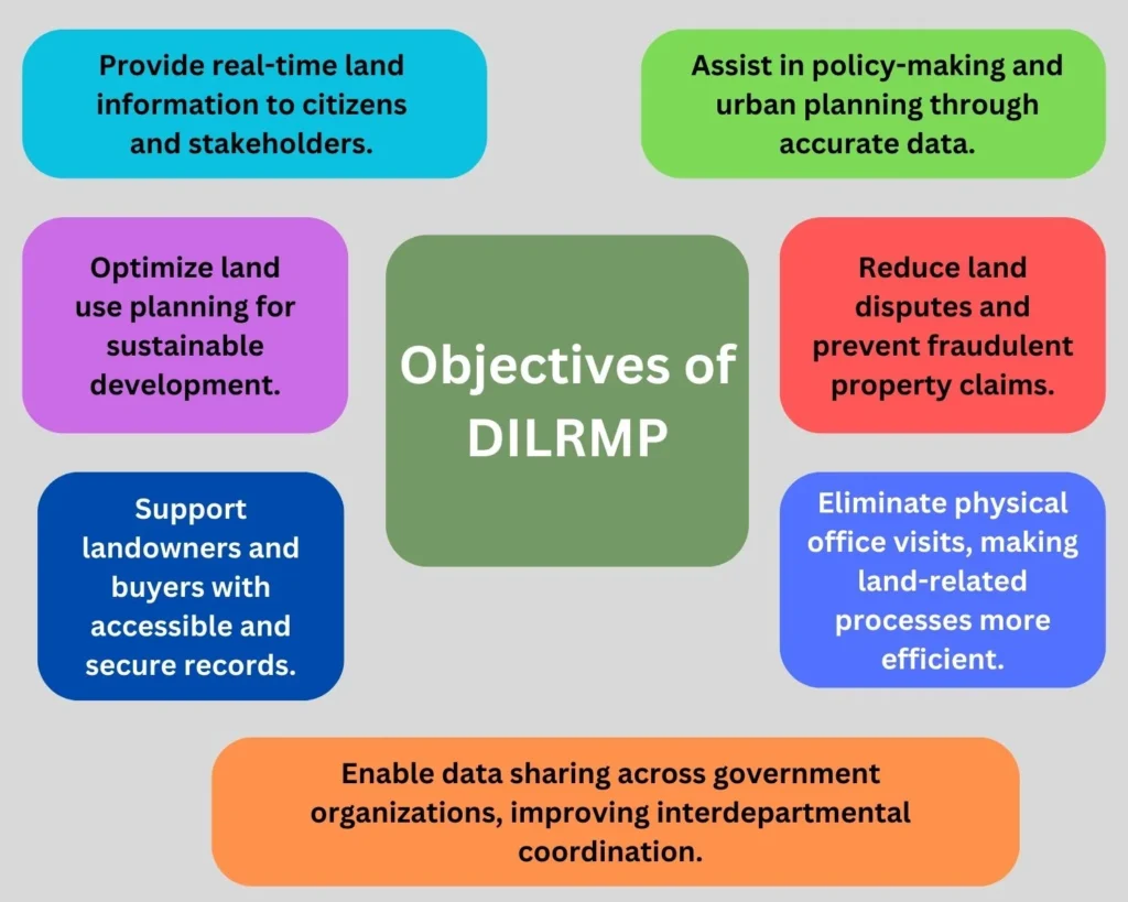
- Provide real-time land information to citizens and stakeholders.
- Optimize land use planning for sustainable development.
- Support landowners and buyers with accessible and secure records.
- Assist in policy-making and urban planning through accurate data.
- Reduce land disputes and prevent fraudulent property claims.
- Eliminate physical office visits, making land-related processes more efficient.
- Enable data sharing across government organizations, improving interdepartmental coordination.
Achievements of DILRMP
The government has achieved significant progress under DILRMP, including:
- 95% of land records digitized, covering 6.26 lakh villages.
- 68.02% cadastral maps digitized, enabling accurate land mapping.
- 87% of Sub-Registrar Offices (SROs) integrated with digital land records.
- Extension of DILRMP until 2025-26, introducing additional features:
- Aadhaar-based land record integration for better security.
- Computerization of revenue courts to speed up case resolutions.
- Enhanced database interoperability to streamline land-related services.
Key Initiatives under DILRMP
1. Unique Land Parcel Identification Number (ULPIN)
The ULPIN (Bhu-Aadhar) is a 14-digit alphanumeric code assigned to every land parcel, based on geo-coordinates. Implemented in 29 States/UTs, ULPIN:
- Simplifies real estate transactions, reducing errors and fraud.
- Resolves property disputes through clear identification of ownership.
- Improves disaster management planning by linking land data to emergency response systems.
2. National Generic Document Registration System (NGDRS)

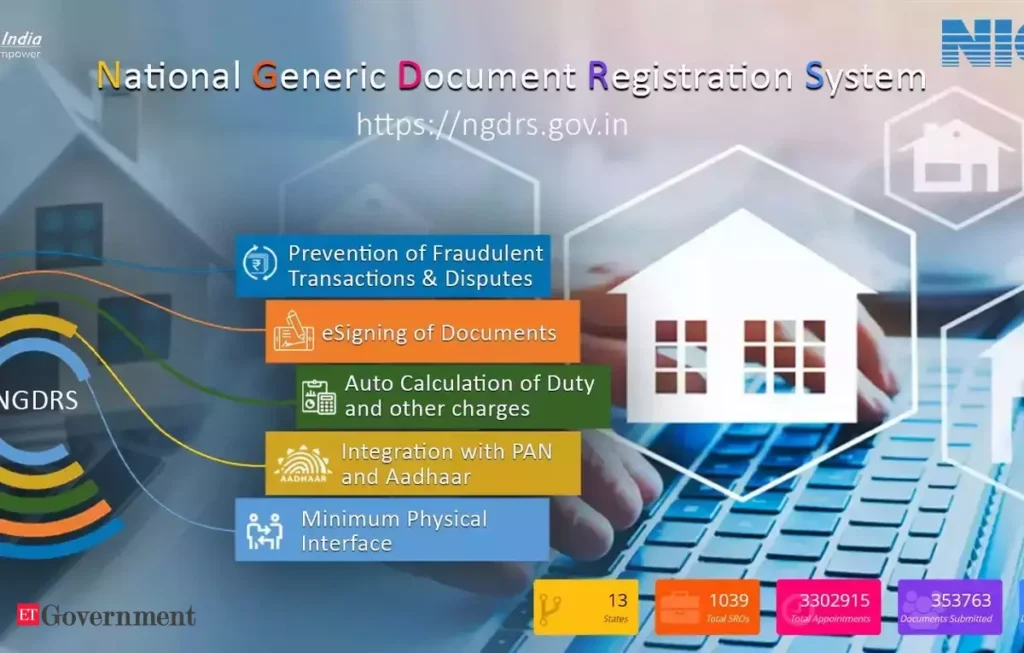
The NGDRS or e-Registration system provides a standardized and uniform approach for deed and document registration across India. The system enables:
- Online entry of land records.
- Digital payments and document searches.
- Remote appointment scheduling, reducing in-person visits.
Currently, 18 States/UTs have fully implemented NGDRS, while 12 others are integrating their data into the National Portal.
3. e-Court Integration
The integration of land records with e-Courts has facilitated authentic land information for the judiciary, leading to:
- Faster legal case resolution related to land ownership.
- Reduction in pending land dispute cases, benefiting citizens.
- Minimized land-related fraud and unauthorized transactions.
This initiative has already been implemented in 26 States/UTs.
4. Transliteration of Land Records
To address language barriers, land records are now transliterated into 22 languages listed in Schedule VIII of the Indian Constitution. This feature is currently active in 17 States/UTs, ensuring wider accessibility.
5. Bhoomi Samman Initiative
The Bhoomi Samman Initiative recognizes districts excelling in land digitization. So far:
- 168 districts across 16 States have achieved platinum grading for completing over 99% of core digitization tasks.
- Land record computerization and cadastral map digitization have been completed in several regions, ensuring seamless land management.
6. Blockchain for Land Records Security
The Indian government is exploring blockchain technology to enhance land records security. Blockchain provides:
- Tamper-proof land records that cannot be altered or forged.
- Smart contracts for secure and automated real estate transactions.
- Enhanced transparency in property ownership transfers.
7. Artificial Intelligence (AI) in Land Record Management
The government is leveraging AI-powered data analytics to:
- Detect land encroachments and illegal constructions.
- Predict land value fluctuations, benefiting buyers and sellers.
- Automate property tax calculations based on land use.
Conclusion
The Indian government’s commitment to land record digitization is a game-changer in ensuring transparency, security, and accessibility in land management. By incorporating modern technologies like geospatial mapping, ULPIN, blockchain, and AI, this initiative strengthens land ownership rights, especially for marginalized communities.
As digital land records become more accessible, they contribute to an inclusive and equitable society, where every citizen has rightful ownership and economic security. The Indian government’s focus on creating an organized and efficient land record system is a step toward a more progressive and prosperous India.


